WALKING AND HIKING IN AND AROUND ANACONDA
Temporary Resident Alan Householder shares his field notes from the many hikes he enjoyed while living in Anaconda.
A great resource for those new to Anaconda, and a great opportunity for long-time residents to see their community through fresh eyes!
A special thank you to Anaconda Trail Society for procuring and sharing this information. The Anaconda Trail Society’s mission is to develop and steward trails for a healthy Anaconda and surrounding community.
First of all, this landscape is vast, its skies wide open with the distance always great. Walking and hiking are exceptional in any direction that you may wish to wander (but your goal is always much further than it looks!). One rarely sees any others in the open spaces that surround this former Copper Smelter town. The town itself is very walkable and extremely interesting with all of its very different styles of heritage houses and buildings. Being self-propelled with a bicycle is a more popular option in traversing through this landscape because of its scale but for the pedestrian who has the time and energy, being on foot may be the most pure and direct way to truly experience the natural essence of this region that sits one mile above sea level and is rimmed by the western continental divide.
Second of all, when outside what really matters is whether the wind is blowing! As Mark Twain once quipped “you can never tell about the weather but you can be damn sure that there’s going to be plenty of it!” Big Sky here means big weather and constant exposure to the elements is always a fact of the matter.
The Anaconda Trail Society offers maps on their website that can be downloaded and is highly recommended to use when hiking most of these suggested routes.
All the listed trails here are also used by mountain bikers who usually are the ones keeping the trails clear and open.
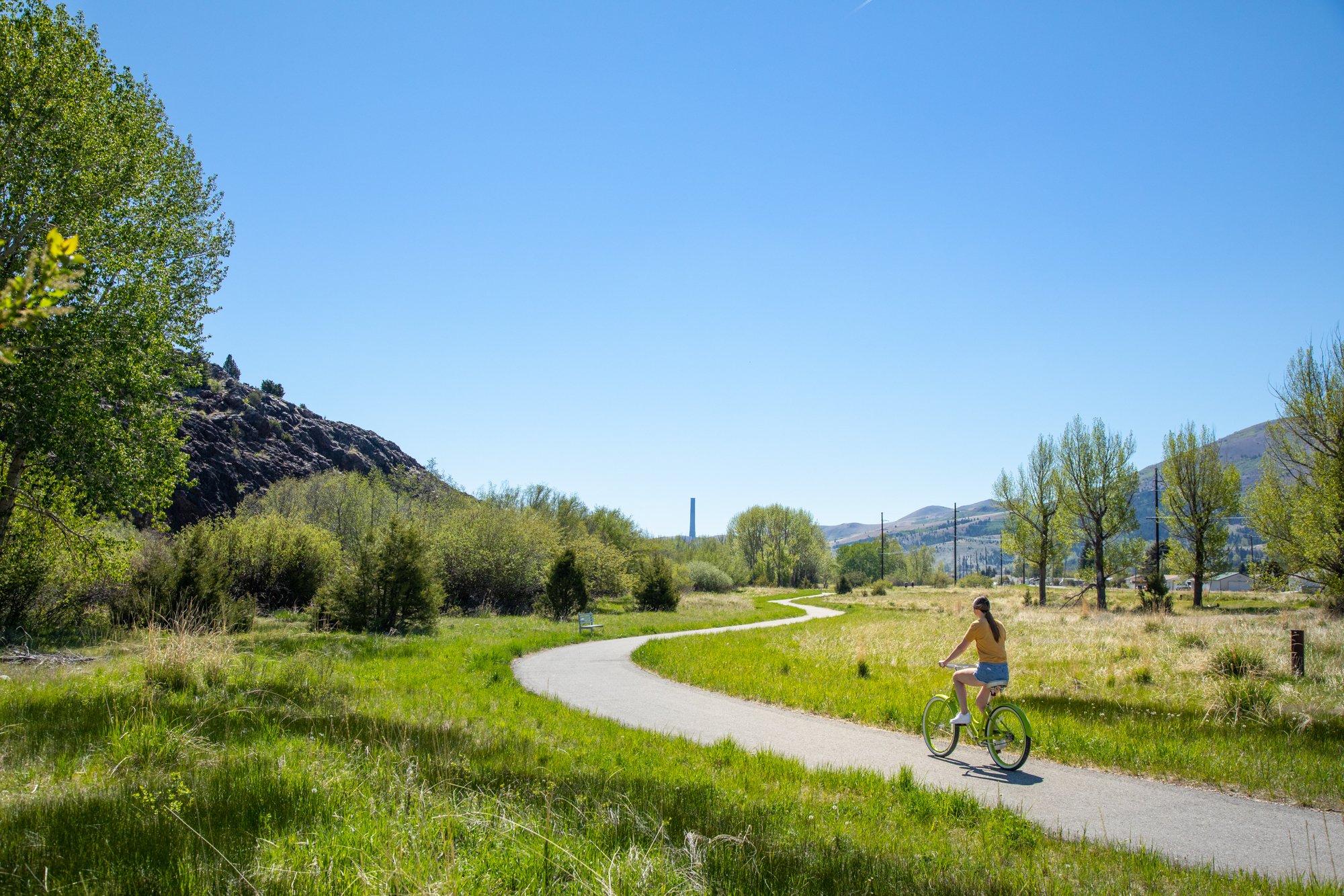
The Upper Works Trail: (1.8-mile round trip - easy) This is the locally most popular hiking trail in Anaconda. This paved route climbs gently to above the ruined site of the Upper Works Smelter. This route overlooks the Old Works Golf Course and offers fantastic views of the Stack, Anaconda, and the Pintler Mountain Range with Mt Haggin. This walking route features several historical interpretive signs and benches as well as two small pavilions. A large parking lot at the trailhead is located at the end of North Cedar Street just across from the Cedar Park Bowling Alley and is signed Historic Trail to the left of the first pavilion. This trail is located about on the halfway point for the Anaconda Way Greenway
The Anaconda Way: (7 miles one way - easy) This is the official town greenway that’s divided into sections showcasing traces and ruins of its historic upper and lower copper works. Also, this greenway passes through forested Washoe Park and ends just beyond the Lorry Thomas Urban Wildlife Area with its big pond at Glenn (Hefner’s) Dam. The greenway parallels Warm Springs Creek the whole distance. The eastern section (also known as the Lower Works Trail- 3 miles) traverses a former superfund site passing The Old Works Golf course which was built on top of a former slag dump and incorporated into something useful and aesthetically pleasing. Also, more old waste was left on the ground surface nearby which is now known as the Red Sands Tailings which the route weaves through. Most pedestrians walk this route in its various sections but walking the entire length is the best way to appreciate the town’s history with its immediate landscape and dramatic mountain backdrop. This route is sometimes graveled and sometimes paved. Currently the trail is fragmented into 3-4 segments and not always posted at some of the trail junctions but can easily be traced (just keep paralleling Warm Springs Creek!) The only major trail junction that is not well marked and can be confusing is the Cedar Street connector. Hiking west on the greenway after passing the Old Works Golf Course, then walking a good distance beside Pizzini Way, arrive at a four-way stop and turn right on North Cedar Street. (Taking a left turn here and walking three blocks will take you to Park Avenue and the historic downtown.) Follow North Cedar Street over a bridge and take left on Copper Sands Road to resume on a paved pathway. At the left turn, but straight ahead is the upper works trailhead. Parking is available at both ends of this trail as well as at the Upper Works trailhead at the end of North Cedar Street. If one completes this walk in the Urban Wildlife Area which ends at a closed gate on Cable Road, one either must backtrack .5 miles or take a left onto Cable Road and walk about .3 miles to arrive back to the parking lot at Glen’s Dam.
Stuckey Ridge: (6 miles round trip) Unofficial route offering outstanding sweeping views of Anaconda, Mt Haggin, and the Pinter High Crest. The route begins off the last switchback on the paved Upper Works Trail roughly .3 miles from its trailhead following a graded trail up a small gulch then switchbacks twice up to the first ridge line. The route disappears shortly before cresting the first ridge line in a recently seeded area. Simply follow the main crest and soon a dirt track appears that eventually merges into a well-used dirt road. Stay on the main ridge road finally climbing steeply until reaching the posted gate for the Anaconda Ziplines where this route currently ends. The whole route is exposed to the elements.
“C” Hill and Double Top via the Silica Trail from Sheep Gulch: C Hill dominates over the town of Anaconda and this route truly is where ‘Main Street meets the Mountains’. The Silica Trail is a non-maintained road climbing steeply almost 2000 ft and roughly three miles to the summit cell towers. The road begins just behind the historic Deer Lodge County Courthouse and passes the Lower Hill Cemetery. After about a mile heading south up Sheep Gulch just after passing a posted gate to the right, three routes diverge ahead where the pitch of the route begins to steepen. Keep to the far right and follow it until it becomes a pleasant single track but steadily climbs first up the drainage then crosses the rugged main road. It climbs and switchbacks and soon crosses the main road again and heads back into the drainage. Eventually the single-track climbs into a high saddle onto another jeep road, this one running north-south. Taking a right turn here will take you a half mile climbing very steeply in several pitches to Double Top that is two open summits on the lower crest of the Pintler Mountains with outstanding views.
Alternatively, take a left at the saddle, follow the jeep track a few hundred yards back up to the main road and go right. The Silica Trail mostly levels out here for the next half mile through woods and open meadows offering some rewarding views towards the south. Ahead, one can shortcut steeply up to the summit road twice to save on some distance or follow the old switch backing road to the exposed summit towers for outstanding 360-degree views. Backtrack or follow the jeep road (which the mountain bikers call “C” Plus) north along the crest which soon plunges straight down through loose talus for over a half mile to several single tracks (the best route is the first single track on the left after entering into a small dense fir forest keeping left at the next two junctions until finally arriving back to the Silica Trail. Turn right here and soon come back out by the Lower Cemetery and Courthouse.
East C Side: Another good hiking option on C Hill that climbs and winds its way along the mid northern slopes contouring in and out of young thick fir groves and open meadows with great views. The trail finally arrives at a large open area on a prominent ridge that provides one of the best views of the massive Anaconda Stack. This six-mile round trip route primarily follows a very pleasant single track (mentioned above) and is probably the best mountain hiking trail that’s closest to downtown. The trail begins like the other C Hill route following the Silica Road behind the Deer Lodge Courthouse. After about a little over a quarter mile take a left onto the first road then steadily ascending arrive soon at another road junction taking the right fork but immediately taking another right onto a single track (called Prelude in C Minor by the local bikers that created it). The track climbs sometimes steeply up through a series of open views of nearby A Hill and Sheep Gulch. Almost halfway up C-Hill, the single track soon levels out and begins its contouring around the mountain. Stay on this delightful track eastward having few times to negotiate short steep pitches until arriving at the open prominent ridge with the big views. Backtrack.
“A” Hill: Another dominant summit point overlooking Anaconda. This route begins behind the Mt. Carmel Cemetery at its highest point along the old Flume Road. Starting at the Deer Lodge County Courthouse follow the Upper Cemetery Road up between both cemeteries making your way generally southwest. Above a green cemetery pump house, climb steadily for a mile up a rough track that follows a narrow ridge line up to the old main road just below the giant “A.” Turn right and descend the rough four-wheel track. Where it steepens with loose rocks, a single track just to the left of the steep road pitch makes for a more pleasant route leading out into an open meadow and fence line. The single-track merges back onto the main jeep road and soon arrives at the old Flume Road at the bottom of the hill. Turn right here and follow the eroded worn-out road for almost a mile back to the Cemetery.
Hearst Lake and Mt. Haggin: (10- or 14-miles round trip from Stumptown Road - moderate to strenuous). The classic alpine walk out of Anaconda. The trailhead is a very small and limited parking lot beside the Anaconda Church of Christ at a closed gate listing some trail restrictions. The route begins on an old road out of the valley for one mile through wide open fields then climbs steadily on sometimes a very rough track through mostly young stunted thick woods for four miles to stunning Hearst Lake, nestled and surrounded by the high crest of the Pintlers. A faint and rough man way continues past Hearst Lake climbing steeply SSW up to a small unnamed and often dry pond then further up past a hunter’s cabin in the last grassy basin on this assent. In this area try to locate a wire cable which makes for a good guide going up the drainage. From this point one climbs very steeply above tree line for roughly 3/4 mile through talus and boulders up into a bowl and finally to the 10,607 ft summit of Mt Haggin.
The Garrity Mountain Grandstand from Stumptown Road: (6 miles round trip). Starting up from the most western parking lot follow and climb sometimes steeply up a jeep road until reaching a gate where the route becomes a less steep single track that contours with great views around the lower eastern slopes of Garrity Mountain. Soon it slightly descends and merges onto another old road coming up below the single track. Turn right and follow this old road that climbs and follows to the right of a drainage. Arrive at an outcropping of volcanic rock where the road continues but on a gentler grade. In about a half a mile be on the outlook for an old track curving up into wide open high meadows. Follow this faint but obvious track climbing through the open fields about a 1/4 mile to where it ends at an old mining site. Here is truly a magnificent grandstand of the Pintler Mountains and a great place to soak in the solitude and silence of this area.
Tin Can Gulch: (4-mile round trip). Five miles west of Anaconda is the Blue-Eyed Nellie Wildlife Refuge allowing Big Horn Sheep a safe passage through Olson Gulch between Garrity and Olson Mountains. Tin Can Gulch samples two miles of this area climbing up the gulch on an abandoned jeep road until it fades out in a high flat area. To access drive west from Anaconda by taking Highway 1 for several miles through West Valley to the trailhead just off the main road on the right past the quarry. A small parking lot is by a gated road. Follow the gravel road west to another gate where there are interpretive signs about the refuge then follow the old, abandoned road south up into the gulch. The return trip offers great views of Garrity Mountain and the Pintler Range.
The Copperway Greenway: A paved greenway still under construction to connect the Anaconda area with the city of Butte. A six-mile section is currently open from the rest area off of Highway 1 outside the small community of Opportunity to the footbridge over Silver Bow Creek just before entering Durant Canyon. This walkway provides being out into the high open landscape paralleling Silver Bow Creek that has been restored and vastly improved after almost 100 years of ecological damage from all of the mining and smelting that occurred in this area. This open and exposed flat walking is a great contrast from all of the mountain hikes described but it is five miles out of town. It is divided by two road crossings into three sections with the occasional bench and two toilet structures provided. There are outstanding views of the Flint Creek Mountains as well as C Hill and the Pintler Range. In the hot summer season, it’s advisable to walk it early or late in the day due to the constant exposure.
OTHER TRAILS NEARBY
Lost Creek Trail to Foster Creek: (11.8 miles - hard). This trail begins in the picnic area after passing the many primitive campsites inside Lost Creek State Park 7 miles north of Anaconda. There is a self-paying fee for entering and hiking in the park. The parking lot for the Lost Creek Trail is on the right just before the picnic area following an old, abandoned road up the valley climbing above a waterfall with impressive mountain cliffs all around. Basically, opened up and intended for mountain biking, it makes for a moderately pleasant, forested walk following the creek upstream. Roughly four miles in are some large open flats that make for a good turning around place for an eight-mile hike. Continuing ahead the route climbs steadily to a saddle and descends into the Foster Creek drainage crossing four to five unbridged stream crossings along the way. A fun way to make the hike more interesting is to set up a campsite in the park, then have a shuttle to the Foster Creek trailhead and hike the almost 12 miles back to your campsite.
Grassy Mountain: (6 miles - moderate) An amazing 3 mile walk on jeep roads along the Continental Divide up to the large open exposed summit where there is an abandoned rustic lookout with fantastic 360-degree views. This hike begins in the Mt. Haggin Wildlife Management Area about 15 miles south of Anaconda along S- 569 (the road to Wisdom off of Highway 1). Drive a mile or so past the rustic Sugar Loaf Lodge to where there is a large parking area on the right. Walk the gravel road for over a half a mile and take the first road that turns right and climbs north up to this awesome summit. You will know it if there is any wind up there!
Warm Springs Holding Ponds Loop: (6 miles - easy). These three very large bodies of water which appear to be lakes were created to be settling ponds for all the toxic waste coming from upstream from all the mining and copper smelting for almost 100 years. The area has recovered remarkably in the last few decades and has been certified as a healthy wildlife habitat, especially with all the various bird populations. This 6-mile loop follows the perimeter of the three holding ponds mostly along gravel roads and crosses for about a mile, a large dam separating Ponds 2 & 3. There are a few small, sheltered pavilions, pit toilets, and benches along the walk. The best place to begin this walk is at the Eagle parking lot a mile or so past the Warm Springs interstate interchange on the north end of the ponds at the headwaters of Clark Fork. There are constant views of the Pintler Range and the Flint Creek mountains in the vast sweeping landscape but be advised that the wind can be rather intense here with all the open exposure! This is another walk best done early or late in the day during the hot summer months.
German Gulch: (8 miles - moderate). This hike out of all that is listed here feels more like just a hiking trail and makes for pleasant walking overall. One accesses this route by starting at the Gregson Station Trailhead on the Copperway Greenway one mile east from the Fairmont Hot Springs Resort and following it about a mile to where it currently ends near the mouth of Durant Canyon. Walk down and cross over the pedestrian bridge over Silver Bow Creek and follow the old, abandoned roadbed into Durant Canyon soon crossing over some railroad tracks. Continue on the old road that soon swings west into German Gulch and becomes a pleasant footpath with mostly gentle grades following the creek upstream. A little over halfway, cross over a small bridge that has a small bench nearby. After steadily climbing and passing through the upper reaches of the canyon the path breaks out into a more open basin with a forest service road nearby with off road vehicles tracks to several campsites scattered about. Gold was discovered here in 1864 and produced $13,000,000 in gold and at one time there was a population of 1,000 living here!
Barker Lakes: (9.5 miles - hard). A few miles west of Anaconda turn left off of Highway 1 onto Yankee Flats Road passing through some houses keeping to the left then drive 1.3 miles up this rough road to the trailhead (some vehicles may have difficulty getting up this road). The first three miles to the first lake are on the easy side but it’s more of a moderate to difficult jaunt getting to the higher second lake which has a large campsite on its backside along with having great views.
Twin Lakes via Twin Lakes Creek Road: (9.1 miles - moderate). A nice relatively long flat hike that could also be wet or boggy through a new growth forest. This trail follows the Four Basin Trail for a few miles but bears left at a trail sign. The second of the two lakes offers some great views. This route is also an alternative way to hike the Continental Divide Trail (also known as the Anaconda Cut Off). The road to the trailhead can be a little rough. Drive several miles west of Anaconda on Highway One then turn left onto Twin Lakes Creek Road just before the Forest Service Spring Hill Campground (which will be on the right side of the road).